Cute Dog Walking Around Golf Course has Collected 6,000 Lost Golf Balls Which Are Donated to Charities
Charles Jefferson must have felt he hit a hole in one when his dog, a cavapoo named Marlo, emerged from the bushes with his lost golf ball.
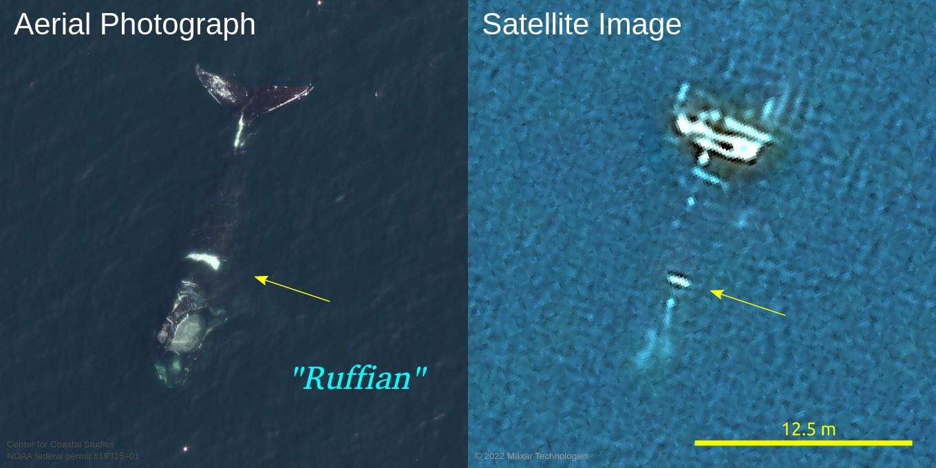
Powerful space satellites that can identify individual whales from their markings have been used for the first time to track a Critically Endangered species.
Scientists are using the tech, which is powerful enough to map a 15 square centimeter area in a single pixel, to follow the North Atlantic right whale to keep them away from ships and find out where they go in the summer and autumn.
The latest satellites are able to capture finer images than Google Earth, meaning conservationists can identify species and even individuals.
By knowing where whales are off to, people could warn fisheries through which the whales pass, or ships to chart a new course in order to prevent collisions and net entanglements.
Writing in the journal Marine Mammal Science the researchers said until now people do not know where 50% of North Atlantic whales go in summer and autumn.
They successfully spotted "Ruffian", a North Atlantic right whale hailing from the Gulf of St. Lawrence who has a large white scar across his back after being injured by fishing gear in 2008.
"The North Atlantic right whale is critically endangered, with about 336 individual whales accounted for," said Matus Hodel, a Ph.D. student at University of Ottawa. "Knowing where the whales are at any given time enables fisheries to open or close to avoid the whales and enables ships to bypass them to prevent collisions."
"This is a new type of satellite imagery which has a spatial resolution of 15 cm, which means each pixel in the image represents 15 cm on the ground," he added. "For context, this is much finer than Google Earth satellite images [and] in some cases, it also allows us to identify individual whales, in circumstances where a whale has sufficiently distinct markings."
The research spanned from April 2021 to late summer 2022, during which the University of Ottawa team conducted aerial surveys to locate and photograph the whales.
It's a part of the Canadian Space Agency's wider smartWhales initiative to explore ways to detect the North Atlantic right whales using space tech.
SHARE This Whale "Watching" Story On Social Media…


Be the first to comment