Incredible Time-Lapse Shows 12,000-Ton Bridge Being Slid into Place Above Highway in Record-Setting Feat
To minimize road closures, a massive chunk of bridge was built atop a moving platform and slid into place above the M42 motorway.

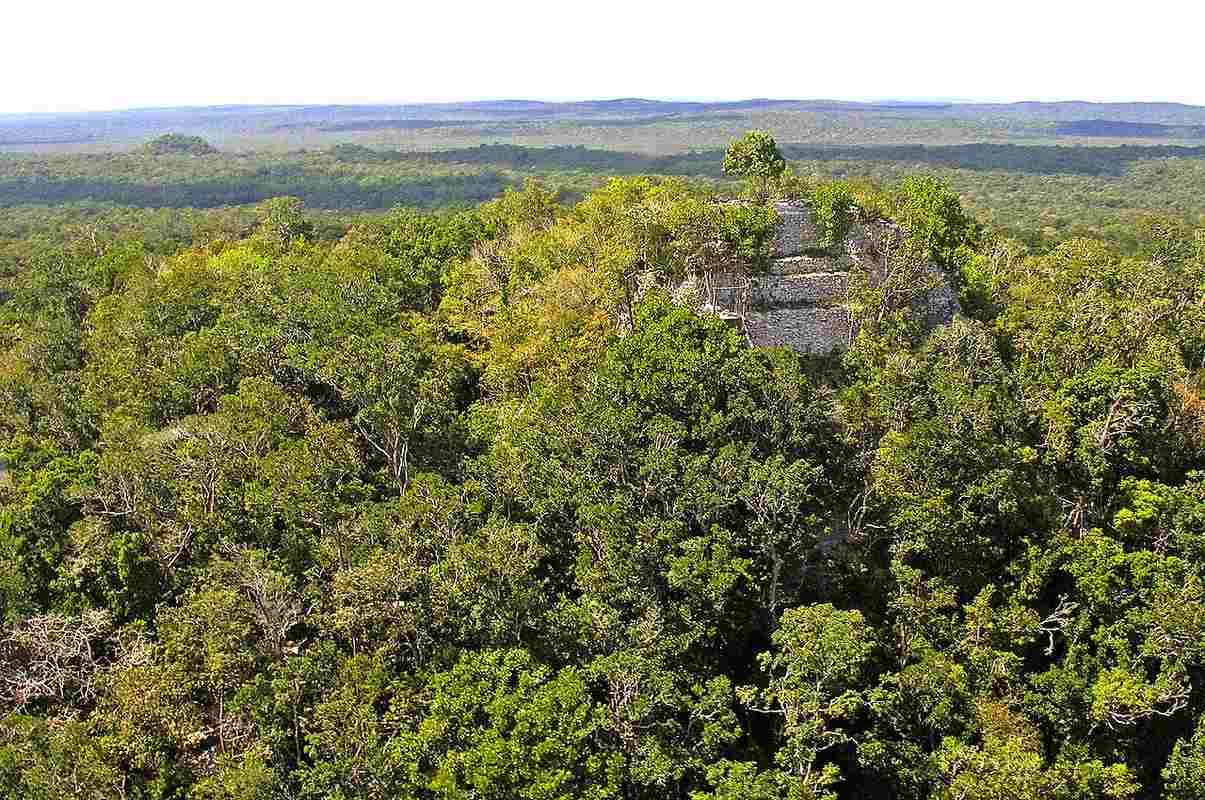
Researchers studying the Mayan Empire have discovered that hidden under the rainforests of Guatemala were more than 900 habitations including at least 4 large cities and thousands of yards of raised causeways connecting them.
Together the research reveals the true scope of territorial reach and technological sophistication of the Maya like never before.
The revolutionary method that led to this discovery was a light detection and ranging (LiDAR) survey, which uses lasers to give centimeter-accuracy of the terrain features below a forest canopy, effectively allowing archaeologists to do what used to take decades of expensive excavations with a few fly overs in a plane.
650 square miles across northern Guatemala's Mirador-Calakmul Karst Basin (MCKB) revealed 30 of the famous ball courts of the Ancient Mesoamerican team sport, 195 cement reservoirs which literally drained nearby lakes dry, and 110 miles of elevated walkways connecting 417 villages.
All of this dates to the middle and late Preclassical period of Mayan History, contemporary with such famous events in the Near East as the sack of the ancient Elamite capital of Susa by Assyria, the destruction of the Temple of Solomon by the Babylonians, and the Greco-Persian Wars including the Battle of Thermopylae.
The past 40 years of traditional excavations in the MCKB revealed around 56 sites, including the city of El Mirador, which contains the largest stone pyramid in the history of the Mayan world, La Danta. 205,508 limestone blocks comprise La Danta, and since it's even larger than the great pyramid of Giza, would likely have required 6 to 10 million days of labor to build.
"The skeleton of the ancient political and economic structure as a kingdom-state in the middle and late Preclassic periods has a tantalizing presence in the Mirador-Calakmul Karst Basin," the research team, led by Idaho State University archaeologist Richard D. Hansen, concluded in its recent study on the LiDAR survey in Ancient Mesoamerica.
LiDAR delivers the goods. A new mapping study of the Mirador-Calakmul Karst Basin (MCKB) of northern Guatemala has revealed over 900 Preclassic Maya sites, condensed into 417 ancient cities, towns, and villages of at least six tiers. pic.twitter.com/KxYYPxywQc
— 🎄Stone Age Herbalist🎄 (@Paracelsus1092) December 20, 2022
LiDAR delivers the goods. A new mapping study of the Mirador-Calakmul Karst Basin (MCKB) of northern Guatemala has revealed over 900 Preclassic Maya sites, condensed into 417 ancient cities, towns, and villages of at least six tiers. pic.twitter.com/KxYYPxywQc
As seen in this Twitter post, having only a topographical visualization of the MCKB, the challenge of trying to make sense of each individual site's level of sophistication was a big one, and the researchers utilized a tiered system with 6 levels. El Mirador with its enormous pyramid is the highest tier, and the other areas march backwards from it.
The authors set definitions for city, town, and village, but admit that their data is limited to visible features on the surface.
"To further complicate issues, the Mirador Basin Project has identified an astonishing presence of "invisible" house mounds, with packed earthen floors, postholes, and Preclassic pottery in situ, but with no surface indications of architecture," the authors write, explaining that some settlements could be larger than the surface architecture suggests.
"The consistency of architectural forms and patterns, ceramics, sculptural art, and unifying causeway constructions within a specified geographical territory suggests a centralized political, social, and economic organic solidarity among the occupants," they continue.
"The magnitude of the labor in the construction of massive platforms, palaces, dams, causeways, and pyramids dating to the Middle and Late Preclassic periods throughout the MCKB suggests a power to organize thousands of workers and specialists, ranging from lime producers, mortar and quarry specialists, lithic technicians, architects, logistics and agricultural procurement specialists, and legal enforcement and religious officials, all operating under a political and ideological homogeneity."
Poor soil conditions in tropical rainforest has long been cited as a limiting factor of Mesoamerican civilization, but not only was it not a problem for the leaders ruling in El Mirador to organize thousands of people for the occasional, Stonehenge-like effort, but for regular construction projects on a vast scale over hundreds of years.
SHARE This Transformative Discovery With Your Friends On Social Media…
Be the first to comment